LiDAR 2004 LiDAR 2009 |
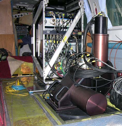
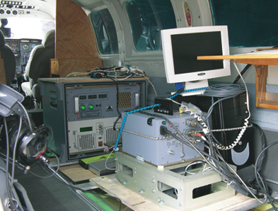
AERIAL SURVEY Capable of producing a digital terrain model to an accuracy of +/- 15-cm, the system is extremely useful for applications where a relatively high degree of accuracy is necessary. In addition, a laser digital elevation terrain model can be produced in a much shorter time frame than a similar product using conventional photogrammetric techniques. The ALTM system is comprised of a high frequency optical laser coupled with GPS and an Inertial Navigation System (INS). A 3-dimensional GPS solution (X, Y, Z) is used to position the laser scanner at each second or half second, while the INS data are used to determine the systems' orientation. The GPS solution is computed from differential kinematic processing, using data collected simultaneously at the aircraft, and at base stations on or near the project site. |
RADAR sensor |
Our orthorectified radar image is produced from our proprietary interferometric synthetic aperture radar (IFSAR) sensors and provides an image in regions where there is persistent cloud cover. The orthorectified radar image is a grayscale radar image of the earth’s surface that has been corrected to remove geometric distortions caused by terrain. This orthorectified radar image accentuates topographic features such as rivers, road networks, and vegetation boundaries. Many geospatial applications can be supported by our orthorectified radar image, including topographic and geological mapping, land coverage classification, and forestry analyses. |
LiDAR project  |
Topographical surveys are what a LIDAR does. At the scanning rates used by Lasermap Image Plus, ground positions and elevations can be collected. This provides a very detailed digital terrain model of the ground, generally far more detailed than any other technology can produce economically. From these data, detailed contours can be produced, or the DTM data can be used in almost any CAD, GIS or terrain modeling software. Operators of gravel pits or open pit mining operations often require an "inventory update". LIDAR provides an ideal speedy methodology for collecting these data for larger properties. |
 |
Since 2002 |
|
|
copyright
2012 - GeoCapacity Co., Ltd. Designed by GeoCapacity Co., Ltd. |